The New York Times, April 20, 1878, p.3:
SUEZ AND THE GREAT CANALWHERE THE ISRAELITES CROSSED THE RED SEA.
THE WELLS OF MOSES--THE SWEET-WATER CANAL--
THE OVERLAND ROUTE--INCREASE OF COMMERCE--
STEAM MARINE--IMPORTANCE OF THE ROUTE--
PROPOSED ALTERATIONS--RATE OF SPEED--
DE LESSEPS AND HIS RESIDENCE.
From Our Own Correspondent.
SUEZ, Egypt, March 10, 1878.
There is not much to see in Suez, and what little there is does not possess any great amount of interest. You have a dirty town, surrounded by the desert; you have dirty streets, dirty houses and bazaars, and correspondingly dirty inhabitants. Water for washing, cooking, and other purposes comes all the way from the Nile by means of the Sweet-water Canal, and is evidently too dear to admit of universal use. Nobody appears to trouble himself much about bathing, and the few that indulge in that practice look as if they had proceeded to roll in the dust before their skins were dry.
There has been a city here for many hundreds of years, but it has remained through all the centuries with very little change. There was a spasm of progress when the Suez Canal was completed, but it was only a spasm, and very soon the place settled back into its old ways. It has a little trade along the Red Sea, and is the point of departure for caravans in several directions; formerly it had the handling of merchandise and passengers between Europe and the East, but since the canal was opened its affairs have declined considerably, though there is still enough to keep it alive.
As for stock sights, it is poorly provided, as it contains no architectural monuments nor anything of historical interest. The guides take you to the reputed spot where Moses and the Israelites crossed the Red Sea, but as the guides do not agree on this point, and each has a pet place of his own, you are left somewhat in doubt.
An ancient mariner tells me that he has seen chariot wheels hanging to the flukes of anchors where ships have left their moorings in the harbor of Suez, and once a fisherman found a sword with a well-defined "P" on its blade, followed by the letters "B. C.," and some indistinct figures. He conjectures that this was the sword of Pharaoh, and that the chariot wheels belonged to his army. I am inclined to skepticism on the point, particularly as my informant denied any descent from George Washington and his hatchet.
There has been much controversy among the savans as to the exact spot where the Israelites made their crossing and the Egyptians went in pursuit. Among those who have given attention to the matter is Prof. Brugsch, who has been in the employ of the Egyptian Government, and was its Commissioner at the Philadelphia Exhibition. He locates the crossing of the Red Sea at a point a little north of Suez, where the ground is now dry, but bears evidence of having been overflowed in former times. He argues that in the days of Moses the Red Sea was higher and flowed farther to the north than at present...
I have looked all around here and seen no trace of either pursued or pursuers, and when I asked for the Israelites I was referred to a shop in the bazaar where antiquated garments were sold, and to another where watches and spoons would be exchanged (at a low valuation,) for coin.
The guides about the Suez Hotel are clamorous to take you to the wells of Moses where the Israelites made their first camp after crossing the Red Sea. They are very old wells, (and no man knoweth their age,) in a clump of palm-trees, on the eastern side of the Gulf of Suez, about two miles from shore, at a point three miles below the town. They are said to be in exact accordance with the Scriptural account, and their identity is as well established as that of most of the places mentioned in the Bible.
The modern interest of Suez is in its position on the overland route to and from India. At the first establishment of this route by Lieut. Waghorn, steamers came from England to Alexandria, and there landed passengers, mails and cargo. River steamers proceeded through the Mahmoudieh Canal, and up the Nile to Cairo, whence the journey of 80 miles over the desert was made by means of vans or small omnibuses. Each van carried six persons, and they were wedged something like sardines in a can, so that the ride was anything but comfortable.
The vans were sent off at regular intervals, and before reaching Alexandria the passengers formed themselves into parties of six and then drew lots for the order of their departure. Those who were fortunate secured the latest numbers, as the first batch was started immediately on the arrival of the steamboat at Cairo and waited all day in Suez, while the last lot had their waiting at Cairo, where there was plenty to interest and amuse them.
In course of time the railway was built across the desert, and the vans disappeared; and later on the railway was extended to Alexandria, so that Cairo was quite left out of the route of the overland passenger who could not stop over at least one trip.
At present, the mails and through passengers go by rail (250 miles) between Suez and Alexandria, in 12 hours, and the departures of the steamers at the one port are dependent upon the arrivals at the other. Whenever a mail steamer arrives, a train is sent off as soon as possible, and the ship at the other end of the line has her steam up and everything in readiness to depart the moment she has her consignment on board.
Contrary to the general belief, the fast mails do not pass through the canal, as by so doing more than two days would be lost, and two days in the transport of letters is an important item.
The canal debouches into the Gulf of Suez in front of the town which bears its name; from the veranda of the hotel every vessel passing in or out of the canal may be distinctly seen, and the initiated can make out the name and rig of any steamer of their acquaintance. The canal has enough to do, and sometimes it is so crowded that steamers are obliged to wait for hours before they can enter.
Since the opening, in November 1869, the business of the canal has steadily increased. Beginning at the 1st of January, 1870, it has been as follows:
SHIPS PASSED THE CANAL.
In 1870............
In 1871............
In 1872............
In 1873............
|
489
763
1,082
1,173
| |
In 1874............
In 1875............
In 1876............
|
1,264
1,494
1,457
|
The decrease in the last-named year was only apparent, as the tonnage was greater than in 1875, and the receipts of the canal were proportionately larger.
In 1877 the number increased to 1,663, with a receipt of very nearly 33,000,000 francs, against a little over 5,000,000 francs in 1870. Every year the average tonnage of ships passing through the canal is greater than that of the previous year. The 1,494 ships of 1875 had a capacity of 2,940,000,000 tons, while the 1,457 of the following year measured 3,072,000,000 tons, and the 1,663 ships of 1877 footed up an aggregate of nearly 3,419,000,000 [note: these tonnage figures, in the billions, appear to be erroneously 1,000 times too high].
The greatest increase, both in average and aggregate tonnage, has been on the part of England, whose use of the canal in 1875 and the two following years amounted to 1,061, 1,090, and 1,303 ships respectively. Deduct these from the figures given in the columns above, and observe how small in proportion was the use made of the canal by other nations. England has been the great gainer by the construction of the canal, although she opposed it to the best of her abilities, and derided the scheme of De Lesseps to open a waterway across the desert. But when she found its uses and advantages she was not slow to employ them, and to watch for a chance for acquiring an interest in the property.
At present England would be in a bad way in the East if an earthquake or other convulsion of nature should render the canal impassable, and her dread lest Russia might seek to blockade it may be easily understood.
Many sailing ships still go via the Cape of Good Hope, but all the steam commerce between England and the East takes the canal route.
|
| | |
see also: Libya News - Israel News - Sudan News - Saudi Arabia News
|
|
All of Egypt is
one time zone at GMT+2, with
DST from last Thu in Apr to last Thu in Sep.
|
Egypt News
The regularity and richness of the annual Nile River flood, coupled with semi-isolation provided by deserts to the east and west, allowed for the development of one of the world's great civilizations. A unified kingdom arose circa 3200 B.C. and a series of dynasties ruled in Egypt for the next three millennia. The last native dynasty fell to the Persians in 341 B.C., who in turn were replaced by the Greeks, Romans, and Byzantines.
It was the Arabs who introduced Islam and the Arabic language in the 7th century and who ruled for the next six centuries. A local military caste, the Mamluks took control about 1250 and continued to govern after the conquest of Egypt by the Ottoman Turks in 1517.
Following the completion of the Suez Canal in 1869, Egypt became an important world transportation hub, but also fell heavily into debt. Ostensibly to protect its investments, Britain seized control of Egypt's government in 1882, but nominal allegiance to the Ottoman Empire continued until 1914. Partially independent from the UK in 1922, Egypt acquired full sovereignty following World War II.
The completion of the Aswan High Dam in 1971 and the resultant Lake Nasser have altered the time-honored place of the Nile River in the agriculture and ecology of Egypt. A rapidly growing population (the largest in the Arab world), limited arable land, and dependence on the Nile all continue to overtax resources and stress society. The government has struggled to ready the economy for the new millennium through economic reform and massive investment in communications and physical infrastructure.
CIA World Factbook: Egypt
Area of Egypt:
1,001,450 sq km
slightly more than three times the size of New Mexico
Population of Egypt:
80,335,036
July 2007 estimate
Languages of Egypt:
Arabic official
English and French widely understood by educated classes
Egypt Capital:
Cairo
Egypt Reference Articles and Links
Wikipedia: Egypt - History of Egypt
The Economist: Egypt Country Briefing
LOC: Egypt Country Study
BBC Country Profile: Egypt
UK Foreign Office: Egypt Profile
US State Department: Egypt Profile
Maps of Egypt
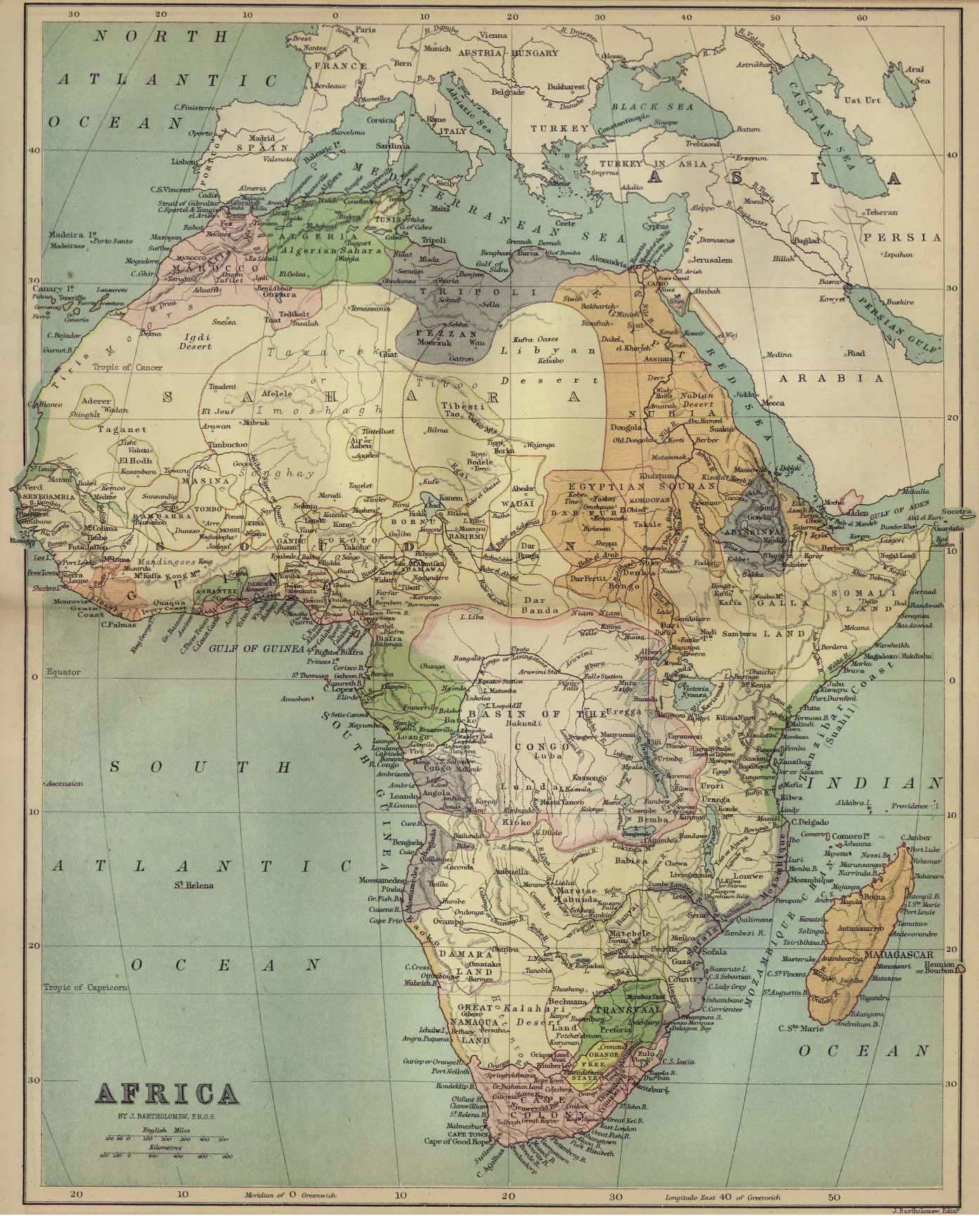
Historic Maps of Africa
1885 Map of Africa
Embassy of Egypt, Washington D.C.
Governments on the WWW links
WikiTravel: Egypt
US State Dept Egypt Travel
Egypt News Websites
The Egyptian Gazette
Reuters: Egypt News
Egypt Today online magazine
Al-Ahram Weekly
Egypt State Information Service
Gomhuria Online in Arabic
Mena.org in Arabic
ABYZ: Egypt News Links
Egypt Internet Directories
Yahoo!: Egypt directory
Google Egypt directory
|