The New York Times, November 7, 1886, p.6:
ALONG EQUATORIAL AFRICACROSS RIVER CLIMATE AND BLACK CHIEFS AT HOME.
INTENSE HEAT AND HEAVY RAINS--DUKE TOWN AND CHIEFS OF THE HILLY DISTRICT--A SCHOOLHOUSE.
CREEK TOWN, CROSS RIVER, WEST AFRICA, Sept. 16--The cool temperature which we found on the south side of the equator is being amply counterbalanced by the stifling, breezeless, vapor bath heat to the north of it, of which our present position, more than 50 miles from the sea, between two thick walls of rank tropical vegetation, is giving us an experience more striking than agreeable. I have already quoted the famous couplet:
Beware, beware of the Bight of Benin
For one that comes out, there were forty went in.
|
But the sister gulf might be justly described in a similar fashion:
Beware, beware of the Bight of Biafara,
Which toasts every white man as black as a Kaffir, ah!
|
It is in such places that one learns to appreciate the real conditions of life in the tropics and the overwhelming difficulties which beset every European whether trader or soldier, in contending with the untamed might of equatorial nature. Sitting sungly at home in an armchair, with a map of Africa on one's knee, it is easy enough to make successful campaigns or establish thriving markets, to bridge rivers, hew down forests, and construct level highways, and to prate glibly of "all obstacles yielding to the magical power of science and determination."
But the man who has to translate these comfortable theories into fact naturally begins to lose faith in the efficacy of science and determination when he finds his new highroad buried several feet underwater by a single storm, his bales of cloth devoured by white ants, his bridges swept away like straws by a flood or a landslip, his half-cleared jungles springing up again faster than he can cut them down, his trading stations torn in pieces by a tornado or plundered and burned by a gang of marauding savages, himself and his colleagues prostrated three or four times a month by fever or dysentery.
Happily the prevalent heat--although quite sufficient to justify our Captain's forcible assertion that he would rather "have his nose rubbed with a brick than write a letter"--falls short of the amazing temperature ascribed to this region in the fourteenth century by good old Sir John Maundeville:
|
Now in this Lybique (African) sea there bene no manner of fish, forasmuch as the water thereof is boiling hot, like unto the water of a caldron, so that all fish which happen therein do die straightaway, neither may any live there in any wise.
|
To pull up a dish of cooked herring or cod straight out of the sea would certainly be an interesting novelty, recalling the inventive Irishman who gave his fowls hot water to dring "so that they'll be afther layin' boiled eggs." But even as it is, the damp, steaming heat that makes every breath a labor is a dismal change after the glorious freshness of Ambas Bay, (our intermediate halting place between the Cameroons River and our present station,) annexed by England in 1884 as a set-off against Bismarck's pounce upon Cameroons.
The worthy folks who think of Africa as a boundless desert, flat as a fashionable novel, and bare as a subscription list, would be mightily astonished by the panorama of this splendid bay, which is unquestionably the finest specimen of African scenery that we have encountered since losing the sight of the coast of Angola.
On entering the bay one might almost fancy one's self the first explorer that had ever penetrated it, so silent and lonely is the aspect of the vast shadowy mountains which, clothed with an unbroken mass of dark woods from base to summit, start up sheer out of the sea on every side. Overshadowed by these mighty ramparts our steamer looks a mere toy as she lies motionless on that league-broad expanse of smooth, steel-gray water, in the centre of which Mondolé Island towers grim and solitary, one great castle of clustering leaves.
Amid such surroundings one may well be opressed by that unquiet sense of being an alien and an intruder which haunted me amid the tremendous desolation of the Sahara Desert and the cold, unearthly splendor of the Himalaya.
But on a closer inspection the signs of man's presence begin to assert themselves here and there in this great sanctuary of nature. Far away to our left the sea of dark-green foliage, outspread over the curving shore, is broken at one point by a patch of yellowish brown suggestive of withered leaves, but really formed by the grass thatches of the 20 or 30 hovels composing a native "town."
In front of us stand, perched on the only strip of level beach anywhere visible, the two small white cottages forming the missionary "village" of Victoria, while on our right, half way up the shaggy side of Mondolé Island, hangs like a picture upon a wall the little whitewashed hut of bamboo which is the present residence of the British Vice-Consul, whose boat, with the union jack fluttering at her stern, comes gliding out toward us from among the trees as we stand watching.
Just then an officer calls our attention to the famous "tunneled rocks," which are perhaps the most characteristic feature of this region of wonders. On the northern side of the bay a sombre procession of craggy islets, crested with dark-green clumps of overhanging trees, stretch forth from a projecting headland into the sea.
Through each of these rocky towers the ceaseless hammering of the waves has hewed a mighty arch, huge and massive and gloomy as the portal of the underground temple at Elephanta, and around the grim gateways which they have fashioned the breakers are still roaring and leaping and dashing in mast-high spouts of foam, like monsters of romance guarding the door of some enchanted palace against the coming of the champion destined to break the spell.
But the bustle and shouting that greet the arrival of the vice-consular boat make us turn round just in time to see coming up the ladder toward us a figure which at first sight seems appears to be that of a slim, palefaced, rather limp boy in a straw hat, who may have overworked or overeaten himself at school and had to take a holiday. On a nearer view this surmise is contradicted by the light smear of down on his upper lip, but had I not previously met him in the Calabar district, I should certainly be slow to believe that this soft-voiced, smooth-cheeked little fellow can really be the local representative of the majesty of the British Empire, the ascender of the Congo as far as Bolobo, the most recent explorer of the Upper Cameroons--in a word the reknowned H. H. Johnstone himself, author of The River Congo.
At Duke Town, the capital of the Calabar district, (which lies a few hours sail to the west of Ambas Bay,) we met another man of some celebrity, who, in virtue of his dignity as British Consul, inhabited the ugliest house in the whole settlement. This was Mr. Hewitt, who was a good deal heard of two years ago in connection with the German annexation of the Cameroons, and who is otherwise known to the world as the brother of that Admiral Hewitt who, as Paddy would say, "succeeded in failing" in his famous mission to King John of Abyssinia at the close of the Soudan war.
Beyond Duke Town--which I have fully described in a former letter--is Old Town, a tiny cluster of trading houses and stores on the brink of the river, overhung by a steep bank. A few miles further up the stream lies Creek Town, named from the creek which connects it with Cross River. Our voyage up to it in the ship's steam launch--for no larger craft could have threaded its way through the gloomy maze of drowned thickets that lay between--gave us a good idea of what Equatorial Africa really is.
Scarcely had we come in sight of the town when a torrent of rain, which made the whole sky seem like one waterfall, drove us ashore to seek shelter in the nearest house, where a hospitable English trader at once made us welcome. From his spacious veranda--upon the sloping roof of which the great bullets of rain came hammering with a noise like the roll of a drum--we looked down upon a perfect sea of intertwined boughs and dark coiling leaves, so thickly massed together that within a few paces of the edge of the clearing that surrounds the house 100 men might lie in amush without giving the slightest token of their presence.
When we went back to the launch we found it nearly level with the top of the rude wooden pier to which it was moored, the creek having risen several feet in an hour and a half. In fact, there are only two ways to Creek Town--one by water and the other under water. When the current permits--which it very seldom does--you may go thither by water, and when you find two natives strong enough to carry you on their shoulders through the swamp, you may go by land, or rather by mud. Beneath the wide waste of rank grass and black half-liquid mire encircling the little cluster of thatched huts lies buried fathoms deep the road that once led to it. The neat little mission building, with its adjoining church, and the smart new house belonging to the local King--for every acre of West Africa seems to have a king of its own--are almost the only redeeming points of this amphibious "town."
I must not forget to chronicle my visits to the two principal chiefs of the hilly district lying immediately behind Duke Town, in company with the ship's doctor, always a welcome visitor among men who habitually do their best to destroy with overeating or overdrinking (and not unfrequently with both) what little health the prevalent fevers of the country have left them.
|
| | |
load map above: Lagos - Calabar
see also: Niger News - Cameroon News
|
|
All of Nigeria
is one time zone at GMT+1,
with no Daylight Savings time.
|
Nigeria News
In ancient and pre-colonial times, the area of present-day Nigeria was occupied by a great diversity of ethnic groups with different languages and traditions. These included Islamic empires in northern Nigeria and smaller organized political groupings in southern Nigeria.
British influence and control over what would become Nigeria and Africa's most populous country grew through the 19th century. In 1914, the British amalgamated their separately administered northern and southern territories into modern-day Nigeria. A series of constitutions after World War II granted Nigeria greater autonomy.
After independence in 1960, politics were marked by coups and mostly military rule, until the death of a military head of state in 1998 allowed for a political transition.
In 1999, a new constitution was adopted and a peaceful transition to civilian government was completed. The government continues to face the daunting task of institutionalizing democracy and reforming a petroleum-based economy, whose revenues have been squandered through decades of corruption and mismanagement. In addition, Nigeria continues to experience longstanding ethnic and religious tensions.
Although both the 2003 and 2007 presidential elections were marred by significant irregularities and violence, Nigeria is currently experiencing its longest period of civilian rule since independence. The general elections of 2007 marked the first civilian-to-civilian transfer of power in the country's history. National and state elections in 2011 and 2015 were generally regarded as credible. The 2015 election was also heralded for the fact that the then-umbrella opposition party, the All Progressives Congress, defeated the long-ruling People's Democratic Party that had governed since 1999, and assumed the presidency, marking the first peaceful transfer of power from one party to another. Presidential and legislative elections were held in early 2019 and deemed broadly free and fair despite voting irregularities, intimidation, and violence.
CIA World Factbook: Nigeria
Area of Nigeria:
923,768 sq km
slightly more than 2x the size of California
Population of Nigeria:
230,842,743 (2023) | 149,229,090 (2009)
Languages of Nigeria:
English official
Hausa, Yoruba, Igbo (Ibo), Fulani
Nigeria Capital:
Abuja
moved from Lagos in 1991
ABUJA WEATHER
Nigeria Reference Articles and Links
Wikipedia: Nigeria - History of Nigeria
BBC Country Profile: Nigeria
US State Department: Nigeria Profile
Maps of Nigeria
1955 US Army Topo Maps of West Africa
Historic Maps of Africa
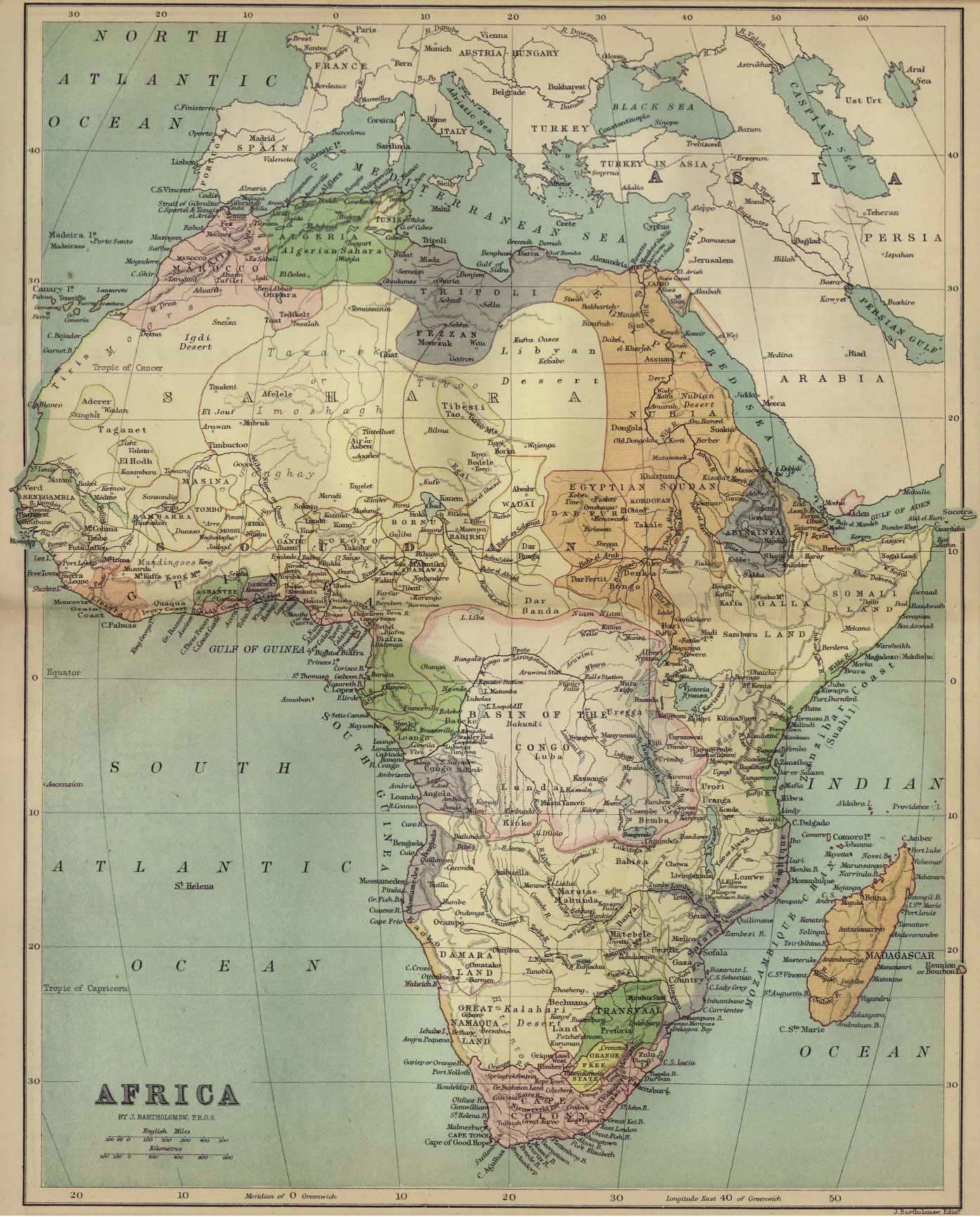
1885 Map of Africa
Nigeria Embassy, Washington D.C.
WikiTravel: Nigeria
Nigeria News Websites
Lagos Daily Sun
Lagos Guardian
Lagos Vanguard
The Nation
ABYZ: Nigeria News Links
|